


The Garmin ECHOMAP Ultra 106sv with the GT56UHD-TM transducer is a high-performance chartplotter and sonar system designed for both recreational and professional mariners. Here’s a comprehensive overview of its features and specifications:
—
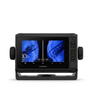
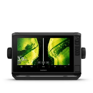
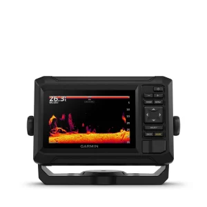
Garmin ECHOMAP Ultra 106sv with GT56UHD-TM Transducer
📺 Display & Build
Display Size & Type: 10″ WXGA IPS touchscreen, offering clear visibility even under direct sunlight.
Resolution: 1280 x 800 pixels.
Mounting Options: Quick-release bail mount and flush mount included.
Waterproof Rating: IPX7, ensuring protection against water ingress.
🛰️ Navigation & Connectivity
Preloaded Maps: Garmin Navionics+ with coverage for U.S. inland and coastal waters, including tide tables.
GPS & GNSS Support: Multi-band GPS with support for GLONASS, Galileo, and BeiDou, providing accurate positioning.
Connectivity: Built-in Wi-Fi for software updates and data sharing; NMEA 2000 and NMEA 0183 compatibility for integration with other marine electronics.
ActiveCaptain®️ App: Allows for smart device pairing, software updates, and access to the Garmin Quickdraw™️ Community.
🎣 Sonar Capabilities
GT56UHD-TM Transducer: Delivers Ultra High-Definition sonar imaging.
Traditional CHIRP Sonar: Frequencies of 70/83/200 kHz (Low, Medium, High).
ClearVü & SideVü: Scanning sonar with frequencies of 260/455/800/1000/1200 kHz, providing detailed underwater imagery.
Panoptix™️ Support: Compatible with Panoptix LiveScope™️ system for real-time sonar imaging (transducer sold separately).
⚙️ Performance & Power
Power Output: 600W RMS.
Power Consumption: Typical draw of 2.5A at 12V DC; maximum draw of 5.0A.
Operating Voltage: 9 to 18 VDC.
—
Common Customer Questions
1. What maps are included with the Garmin ECHOMAP Ultra 106sv?
The device comes with preloaded Garmin Navionics+ maps, covering U.S. inland and coastal waters, along with tide tables.
2. Can I upgrade the maps on this device?
Yes, you can upgrade to Garmin Navionics Vision+ for enhanced features like high-resolution relief shading and satellite imagery.
3. Is the display readable in direct sunlight?
Yes, the 10″ WXGA IPS touchscreen is designed for clear visibility even under bright sunlight.
4. What sonar frequencies does the GT56UHD-TM transducer support?
It supports traditional CHIRP sonar frequencies of 70/83/200 kHz and scanning sonar frequencies of 260/455/800/1000/1200 kHz.
5. Can I integrate this chartplotter with other marine electronics?
Yes, the device is NMEA 2000 and NMEA 0183 compatible, allowing integration with various marine systems.
6. Does it support real-time sonar imaging?
Yes, it’s compatible with Panoptix LiveScope™️ system for real-time sonar imaging, though the transducer is sold separately.
7. What is the power consumption of the device?
The typical current draw is 2.5A at 12V DC, with a maximum draw of 5.0A.
8. Is there a mobile app for this device?
Yes, the ActiveCaptain®️ app allows for software updates, data sharing, and access to the Garmin Quickdraw™️ Community.
9. Can I create custom maps with this device?
Yes, the device includes Quickdraw Contours software for creating custom maps.
10. What is the warranty period for this device?
Garmin typically offers a 2-year limited warranty on their marine electronics.
Reviews
There are no reviews yet.